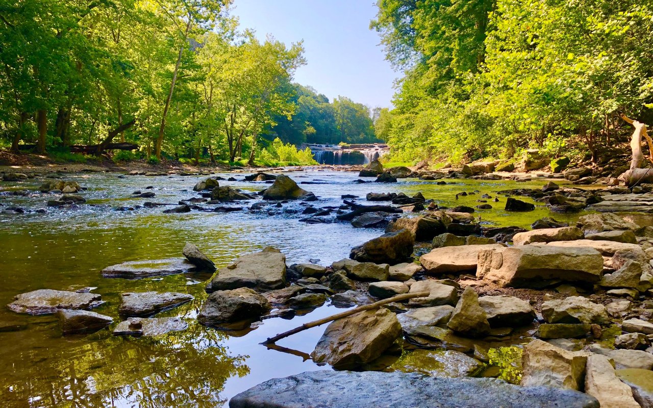
Where do you walk the White River Trail?
Ask that question at Rangeline Park and you'll hear about the technical single track through the woods. Ask it at Shadyside and you'll hear about the two lakes and the covered bridge. Ask it near Grand Avenue and you'll hear about the boardwalk and the herons. All three people are describing the same trail system. None of them are wrong, and none of them have walked the other person's section more than once or twice. Anderson's trail network isn't one loop with a few landmarks along it. It's four or five distinct outings stitched together, and most residents only ever experience the one closest to their own front door.
That's worth knowing, because the version of the trail you default to might not be the one that fits what you actually want to do this Saturday.
One Name, Several Different Afternoons
The White River Greenway runs along the White River on the north side of the city, with the main stretch covering roughly 2.3 miles of paved path along the northeast bank starting at the Grand Avenue bridge. But that's just the spine. Along the way it connects into Killbuck Wetlands, links up with the Shadyside Park trail system, and continues on to Madison Park and Derby Downs, Riverbend Park, Athletic Park, and Edgewater Park. Eight separate trailheads feed into this network, which means eight different starting points, eight different parking lots, and eight different versions of "walking the trail" depending on which one you use.
A quick way to see how different these stretches actually are:
| Segment | Distance | Surface | What you're actually doing there |
|---|---|---|---|
| White River Trail (main stem) | 2.3 miles | Paved | Riverside walk past wetlands, herons, and quiet water |
| Killbuck Wetlands | 0.33 miles | Paved + boardwalk | Slow loop through reclaimed wetland, birding |
| Shadyside Trail | Runs through 60+ acres | Paved | Two lakes, playgrounds, a covered bridge, sculpture |
| Rangeline Nature Preserve | 2 to 6 miles depending on loop | Single track | Mountain biking, from beginner-flowing to technical |
| Mounds Greenway | 1.5 miles | Paved | Connector path toward Mounds State Park |
None of these feels like the others. That's the point people miss when they say they "did the trail" after a ten-minute stroll near one entrance.
The Wetland That Used to Be a Junkyard
Killbuck Wetlands sits where Killbuck Creek meets the White River, and the trail there is short by design: a combined paved and boardwalk loop spanning about a third of a mile, connected to the south loop of the Shadyside Trail. It's easy walking, mostly flat, and the kind of place where you'll see more ducks and geese than people on a weekday morning.
What's easy to miss is what the land used to be. The wetland was created in 1991 on ground reclaimed from an auto salvage yard. Where cars once sat stacked and rusting, there's now a habitat the Indiana Audubon chapter recommends for birding and wildlife viewing. It's dog-friendly, it's shaded in stretches, and if you're the type who wants a walk that takes fifteen minutes and clears your head rather than a workout, this is the segment built for that. It also happens to be one of the better arguments in the city for what a modest patch of reclaimed ground can become with enough patience.
The Loops the City Didn't Build
A few miles from the wetland, Rangeline Nature Preserve is a different animal entirely. The city owns the 180-acre property, but the actual trail work, the bridges, log crossings, teeter-totters, and berms, was put in by a local volunteer mountain biking group over years of hands-on labor. The result is three loops built around skill level. The Novice loop runs about 2 miles of smooth, flowing trail with a couple of creek crossings. Intermediate stretches to roughly 3 miles and adds tighter turns and natural obstacles. Expert climbs to around 6 miles with suspension bridges, elevated sections, and drops that have earned the preserve a reputation among Indiana riders as one of the more technical single-track systems in the state.
There's an unwritten etiquette here worth knowing before you show up. Bikes ride the loops in one direction, and runners are asked to move against that flow and yield to riders on blind corners. It's not posted on a sign at the entrance so much as it's understood by everyone who rides there regularly, which is exactly the kind of detail you only pick up by actually going.
The One Weekend It Turns Into a Race
Most of the year, the White River Trail is a quiet place to walk a dog or push a stroller. Every June, it becomes something else. The Anderson Road Runners Club organizes the White River Run, a 5K and 10K along the paved trail system, with a separate 5K walk option for people who want to be part of it without racing. The course uses a wood boardwalk section, crosses the Blue Bridge, and passes through what organizers describe as a recently developed stretch of riverfront. Recent race listings note newly updated pavement and restored boardwalks along the route, the kind of maintenance that doesn't make headlines but changes how the trail feels underfoot for the other 364 days of the year too.
The club isn't just a race organizer. It also runs Roady Racers, a free summer running program for kids, and partners with Community Hospital Anderson's Community Foundation program on the event itself. It's a small, specific example of the kind of civic infrastructure that keeps a trail system from just sitting there unused between mowings.
Building a Route That Matches Your Actual Mood
Once you see the trail as a set of connected pieces rather than one continuous thing, the useful question changes. It's not "should I walk the trail today," it's "which version of today do I want."
A few honest combinations, based on what's actually out there:
- Slow morning with the dog: Start at Killbuck Wetlands, do the boardwalk loop, then pick up the connector into Shadyside's south end if you want to stretch it longer.
- Family outing with kids: Shadyside Park itself. Two lakes for fishing or boating, a playground, a covered bridge, and enough flat paved ground that a bike with training wheels won't struggle.
- An actual workout: The Novice loop at Rangeline if you're newer to mountain biking, or the main White River Trail stem at a run if you'd rather stay on pavement. Either way you're covering real mileage without leaving city limits.
- Something with a bit of edge: Rangeline's Intermediate or Expert loops, which is where the log crossings and suspension bridges live, and where you'll want a real mountain bike rather than a hybrid.
- A longer haul toward Mounds: The Mounds Greenway picks up west of Chesterfield and runs about 1.5 miles from Anderson Road to the park entrance, which makes it a reasonable extension if you're already out and want to keep going.
None of this requires planning a trip. It's the same city, the same trail system, just used with a bit more intention than "walk to the end and turn around."
What This Says About the City Itself
A trail system this connected, with volunteer labor going into technical mountain bike loops and a reclaimed junkyard turning into a birding destination the Audubon Society actually recommends, doesn't happen by accident. It happens when a place has enough people who care about a specific stretch of ground to keep showing up and improving it. That kind of investment tends to show up in more than just trail maintenance. It shows up in property values holding steady in the neighborhoods near these amenities, in the kind of buyer who asks about trail access before asking about square footage, and in the quiet civic pride that makes a small city feel like it's tending its own backyard.
If you've lived in Anderson for years and only ever use the entrance closest to your house, this is your invitation to try a different one. And if you're the kind of person who's starting to think about where in Anderson makes sense for your next move, whoever you talk to about it should know these details cold, not just the median price on a listing sheet.
That's the kind of local knowledge The McKown Team brings to every conversation about property in Henry County and East Central Indiana. If you want to talk through what a specific block or trail-adjacent neighborhood actually offers, reach out and we'll walk you through it in person.